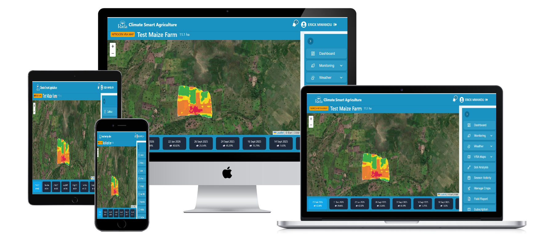
We combine satellite data and advanced AI analytics to deliver climate-smart and precision agriculture solutions. Our digital platform provides continuous soil suitability analysis, crop health monitoring, weather forecasting, early warnings for drought and flooding, yield prediction, soil moisture analysis, variable-rate fertilizer application maps, and crop classification. Through our digital platform, Rada Agriculture, farmers can access actionable insights anytime, anywhere using a mobile phone or computer.
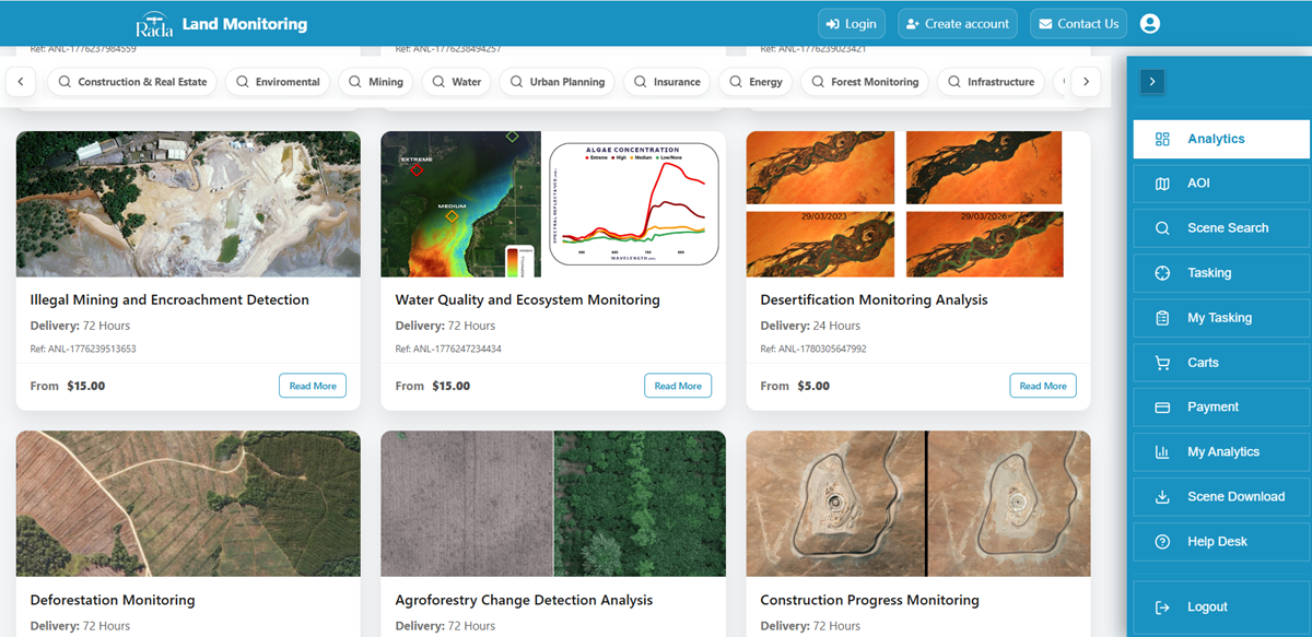
Rada 360 delivers satellite-powered environmental and operational intelligence to support sustainable development and informed decision-making across multiple sectors, including mining, environmental management, disaster management, agriculture, water resources, urban planning, infrastructure, construction, forestry, energy, and insurance. Through high-resolution satellite imagery (archive and tasking), SAR imagery, digital elevation and surface models (DEMs/DSMs), and AI-powered geospatial analysis, our integrated platform provides timely geospatial insights that help governments, mining companies, development organizations, insurers, and enterprises reduce risk, strengthen environmental compliance, and make confident operational and investment decisions.
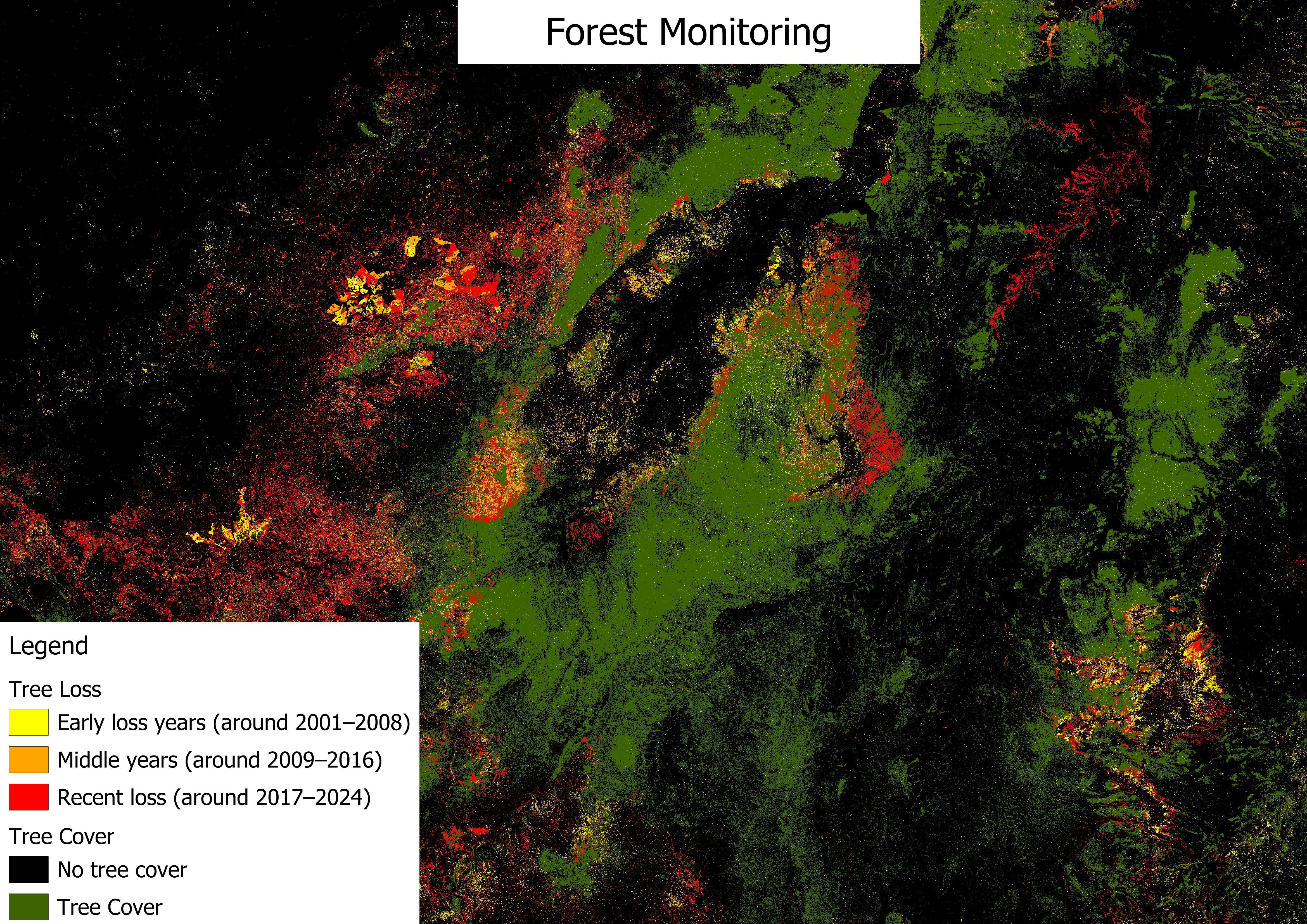
We provide comprehensive forest intelligence and ecosystem monitoring solutions powered by high-resolution satellite data and machine learning algorithms. Our services include forest mapping, deforestation detection, biomass estimation, carbon stock assessment, biodiversity analytics, and certification compliance monitoring.
See how governments, agribusinesses, and organizations across Africa use Rada's satellite intelligence to solve real challenges on the ground.

Understanding desertificationDesertification is the gradual degradation of fertile land into dr...
Read More
Flood Risk Assessment in Rufiji DistrictRufiji District experiences frequent seasonal flooding ...
Read More
Agricultural Drought Assessment in Babati DistrictBabati District faces frequent agricultural d...
Read More
Forest Management in Ulyankulu Forest Reserve Kaliua TaboraSatellite imagery detects deforestat...
Read More
Landslide in Hanang District ManyaraSatellite data reveals areas prone to landslides in Hanang,...
Read More
Crop Yield Prediction in Mbarali District Mbeya RegionSatellite-based crop yield prediction pro...
Read More
Drought Assessment In Dodoma RegionSatellite imagery reveals increasing vegetation stress in Do...
Read More
Land use in Kinondoni District Dar es salaamUsing satellite imagery, the land use analysis in K...
Read More
Leveraging Earth Observation Data to Revolutionize Agricultural Insurance in AfricaIn the dynam...
Read More


Watch how Rada 360 transforms decision-making


