Early warning systems and risk reduction powered by satellite intelligence, Earth Observation and advanced geospatial analytics.
In recent years Earth Observation satellites have become a critical asset for emergency response teams. Satellites support rapid damage mapping to help guide rescue efforts, enabling faster and more coordinated disaster response.
With increasing population growth, rapid and unplanned urbanisation, climate change, environmental degradation and widespread poverty, more people and assets are exposed to disasters. Many crises occur in fragile and conflict affected states, increasing their complexity and burden on vulnerable nations.
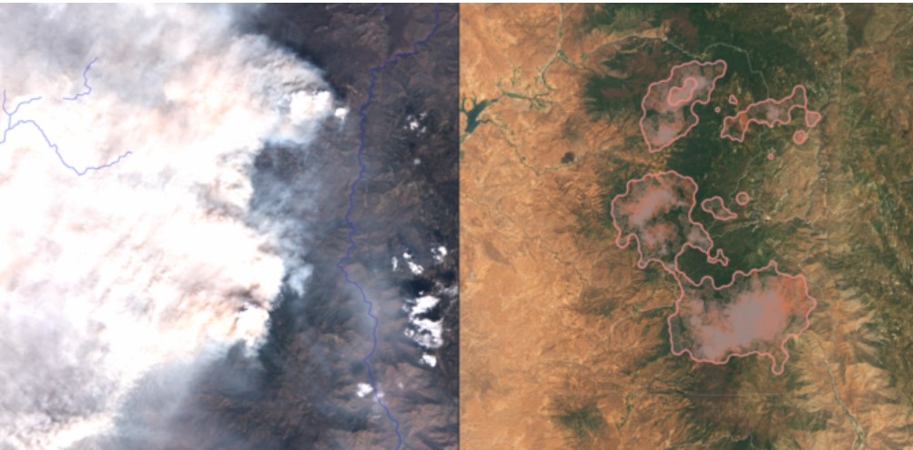
Using high-resolution satellite imagery and spatial analytics, Rada provides early detection and continuous monitoring of wildfire outbreaks, supporting rapid mitigation and environmental protection.
Rada utilizes remote sensing data to map flood-prone areas, monitor active flood events, and assess exposure risks to support emergency planning and infrastructure protection.
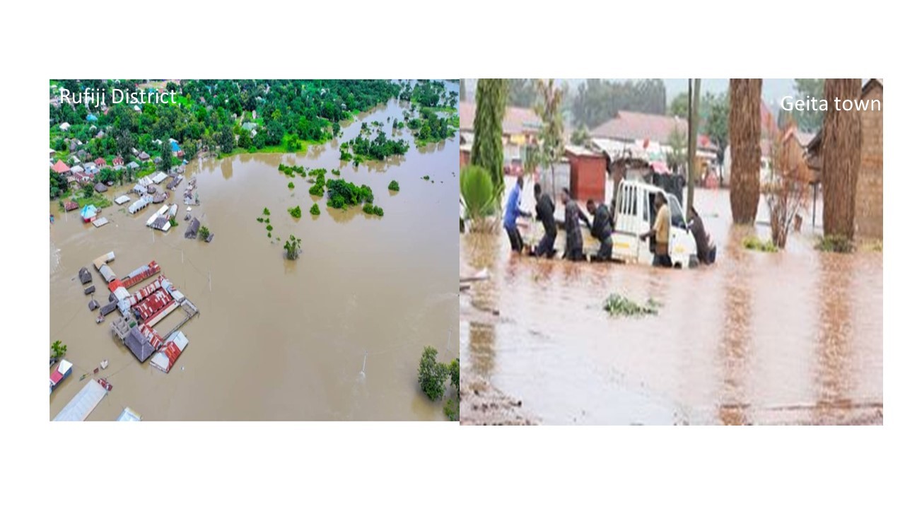
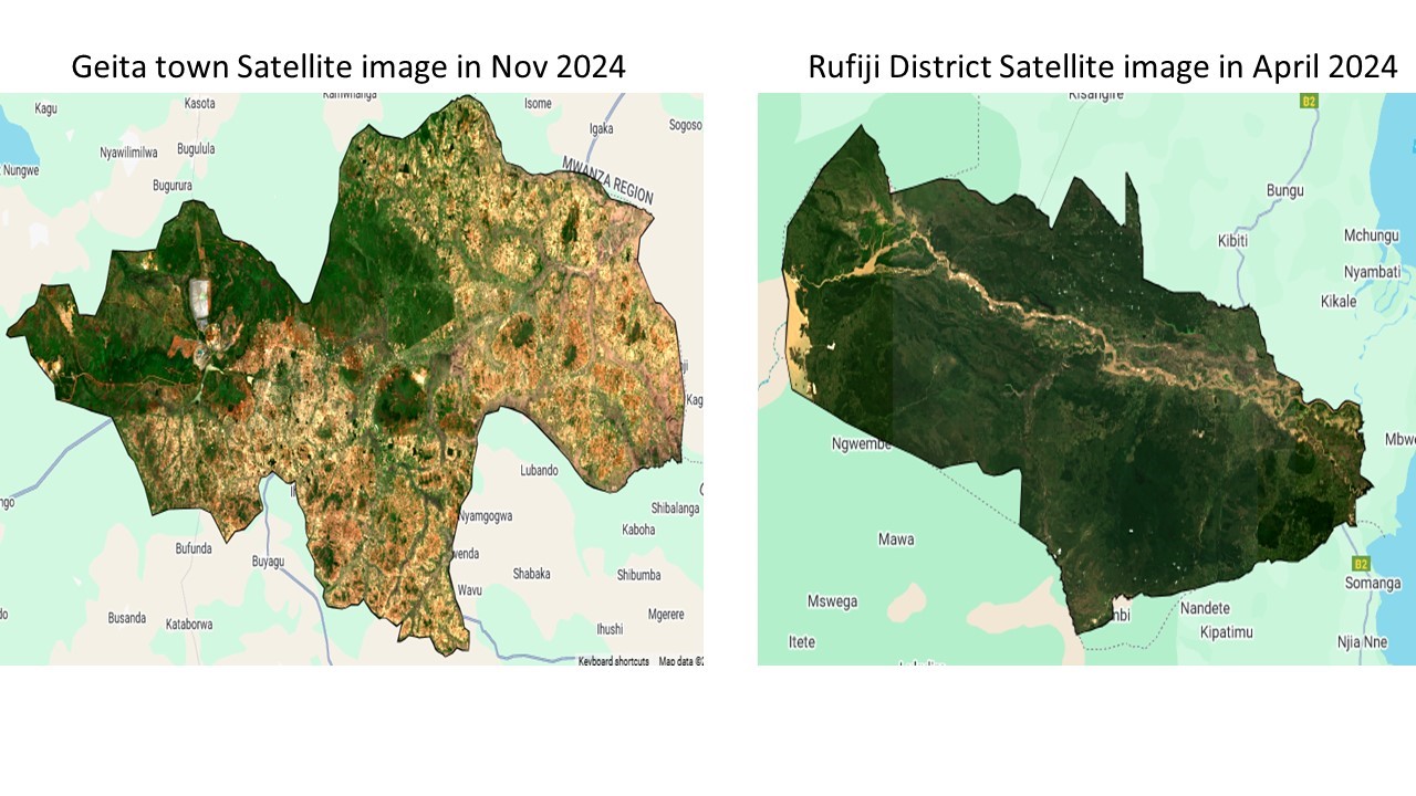
During the April 2024 flooding in Rufiji District and subsequent flooding in Geita Town, satellite imagery enabled rapid flood extent mapping and impact evaluation to support emergency response and recovery.
Through vegetation monitoring, soil moisture analytics and climate modeling, Rada identifies drought onset and severity to support agricultural resilience and sustainable water resource planning.
Rada supports increasing climate resilience by providing innovative Earth Observation services to monitor extreme natural events such as floods, intense precipitation, wildfires, droughts, heatwaves, volcanic eruptions and earthquakes. By understanding hazard frequency and occurrence, it becomes possible to estimate risks, vulnerabilities and potential impacts improving preparedness and long-term resilience.
Leverage satellite intelligence for proactive disaster risk reduction and faster emergency response.
Get Started Today