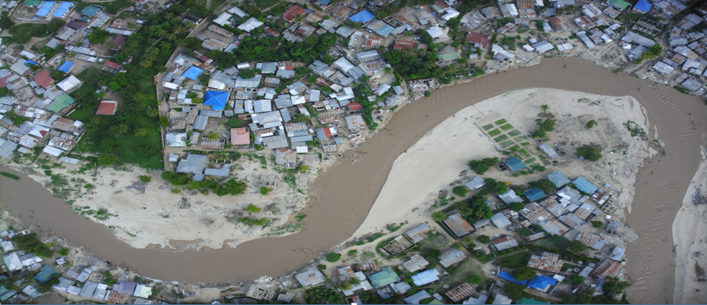
Flood Risk Assessment in Rufiji District
Rufiji District experiences frequent seasonal flooding due to heavy rainfall, river overflow, and low-lying floodplain settlements. Expanding agriculture and unplanned land use continue to increase exposure to flood hazards, affecting communities, farms, and infrastructure.

Flood Risk Assessment in Rufiji District
Using satellite Earth Observation, we assessed flood susceptibility across the district. Flood-prone areas were classified into four risk levels low, moderate, high, and very high allowing clear identification of zones where flooding occurs repeatedly and where communities are most vulnerable.

The results provide actionable insights for planning and disaster reduction. Priority zones were identified for flood control, green buffer protection, and settlement planning. These outputs support local decision-makers with evidence-based data to improve preparedness, reduce risk, and guide climate resilience actions.