Showcasing Rada Space at the Africa Satellite Navigation Conference in Cabo Verde
Showcasing Rada Space at the Africa Satellite Navigation Conference in Cabo Verde Musa Mishamo, the Founder and CEO of Rada ...

Showcasing Rada Space at the Africa Satellite Navigation Conference in Cabo Verde Musa Mishamo, the Founder and CEO of Rada ...
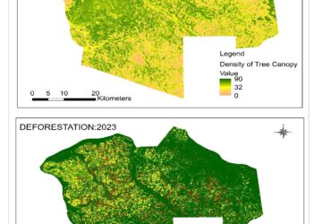
Forest Management in Ulyankulu Forest Reserve Kaliua Tabora Satellite imagery detects deforestation trends, enabling effective monitoring and conservation efforts. This ...
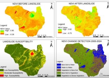
Landslide in Hanang District Manyara Satellite data reveals areas prone to landslides in Hanang, helping identify high-risk zones. Combined with ...
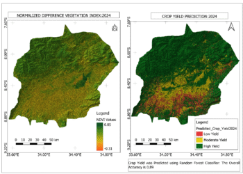
Crop Yield Prediction in Mbarali District Mbeya Region Satellite-based crop yield prediction provides timely insights into agricultural productivity. This supports ...
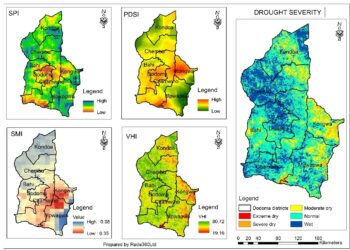
Drought Assessment In Dodoma Region Satellite imagery reveals increasing vegetation stress in Dodoma due to climate change. This analysis helps ...

Rada 360 is a space-tech company providing space based solutions in precision agriculture, Earth Observation and space based on education:
👉 LEARN MORE.