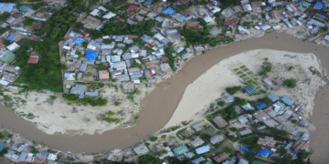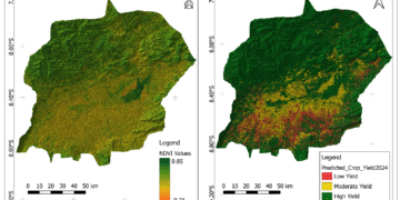
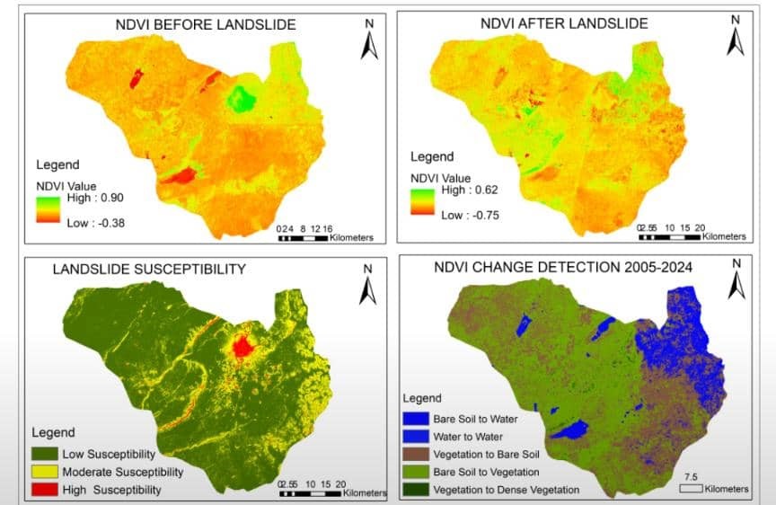
Landslide in Hanang District Manyara
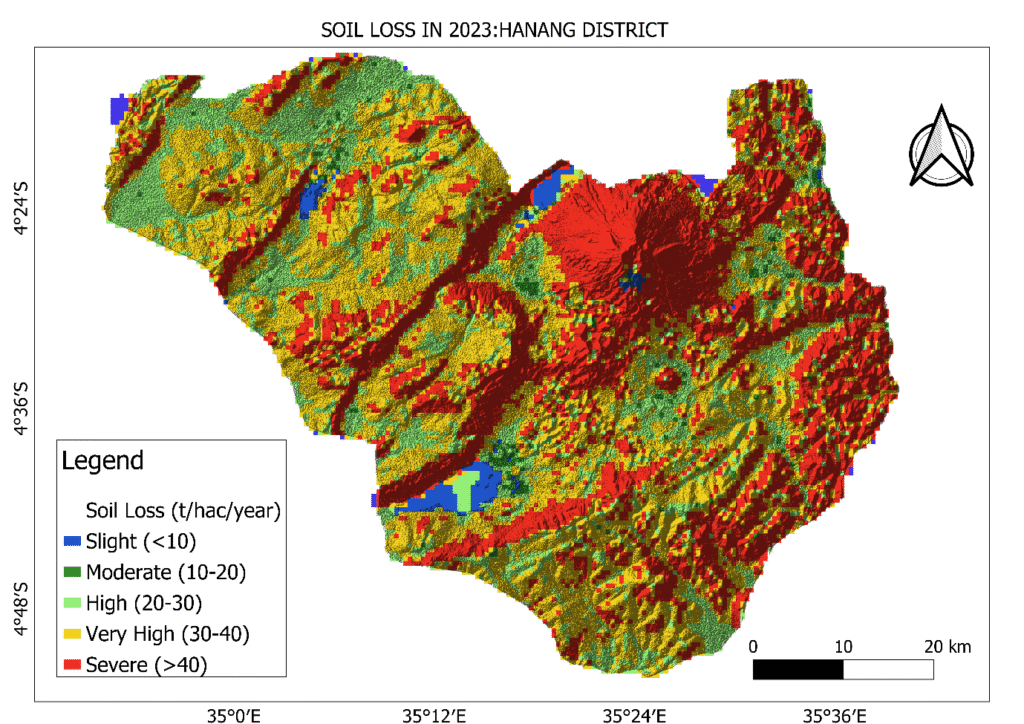
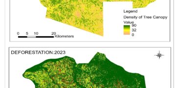
Satellite data reveals areas prone to landslides in Hanang, helping identify high-risk zones. Combined with soil loss analysis using the LUSLE model, the assessment supports disaster preparedness, soil conservation, and informed land use planning to protect lives and infrastructure.