

Rada utilizes Earth Observation data and satellite imagery to provide valuable insights into disaster events (Disaster Management) and deliver early warnings to help prevent disasters. By harnessing the power of satellite data, Rada analyzes flooding, forest fires, and drought, enabling government agencies and stakeholders to assess the extent of damage and losses caused by these events. This data supports the development of prevention strategies and early warning systems, playing a crucial role in safeguarding lives, animals, property, and the environment.
In the realm of natural hazards, Rada offers services focused on:
- Wildfire Monitoring: By employing satellite imagery and spatial analysis, Rada provides early detection and monitoring of wildfires, enabling timely response and mitigation efforts.
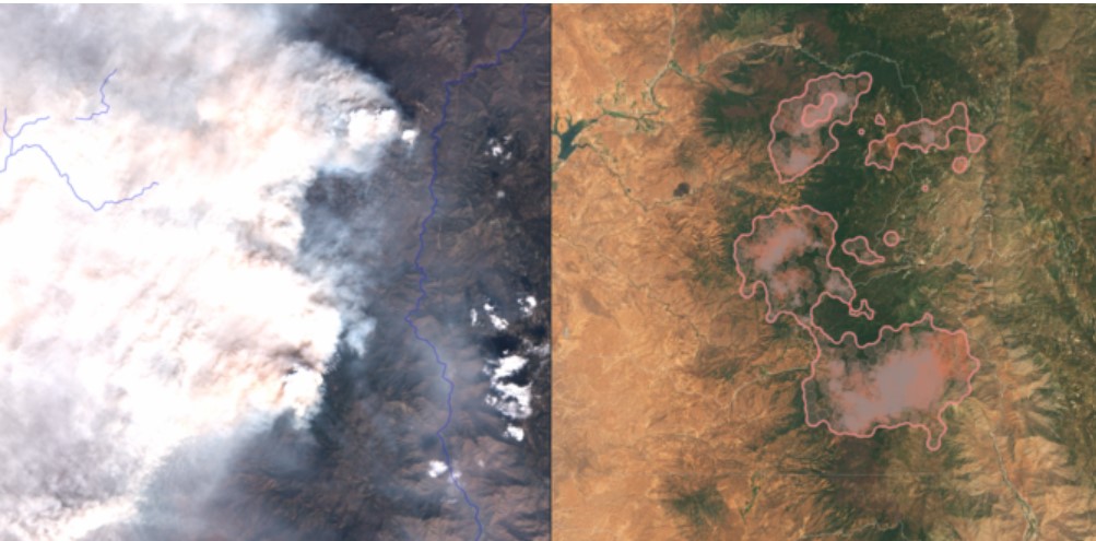
Through reliable space insights and the leading wildfire management platform, we provide organizations with the tools to tackle wildfire challenges, safeguarding forests, ecosystems, communities, and critical assets with advanced technology and actionable intelligence.
- Flood Mapping and Risk Assessment: RSS utilizes remote sensing data to map flood-prone areas, assess risks, and monitor ongoing flood events. This information is crucial for disaster preparedness and response planning.
Case Study
A Tale of Two Floods
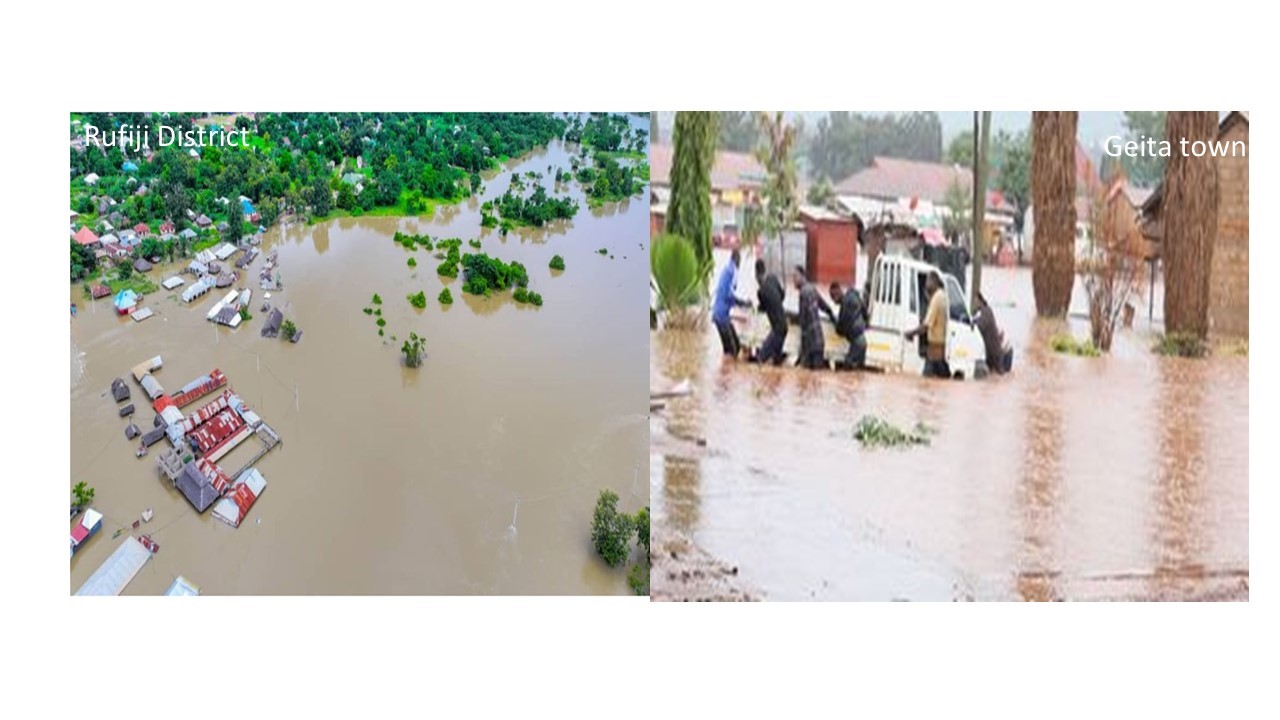
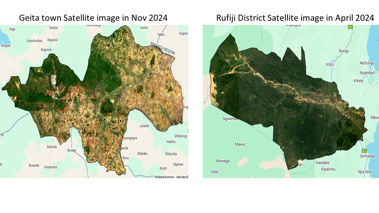
In April 2024, the Rufiji District was engulfed by rising waters, marking the beginning of what experts predict could be years of recurring floods. Just months later, in November 2024, Geita Town District faced its own watery ordeal. As communities struggled to cope with the immediate impact, satellites high above the Earth were capturing crucial data that would prove invaluable in understanding, managing, and mitigating these disasters.
Unveiling Nature’s Patterns: Satellite Insights
Satellite imagery analysis revealed a wealth of information about these flooding events, painting a comprehensive picture of their scope and impact:
- Flood Extent and Depth: High-resolution images allowed experts to map out the precise areas affected and estimate water depths, crucial for immediate rescue operations.
- Temporal Changes: By comparing images over time, analysts tracked the flood’s progression, identifying areas at risk of prolonged inundation.
- Land Use and Land Cover Changes: The floods dramatically altered the landscape, with satellite data revealing shifts in vegetation, urban areas, and agricultural lands.
- Drainage Patterns: Imagery highlighted natural and man-made drainage systems, pinpointing areas where water flow was obstructed.
- Climate Change Indicators: Long-term satellite data provided evidence of changing weather patterns, linking these floods to broader climate trends.
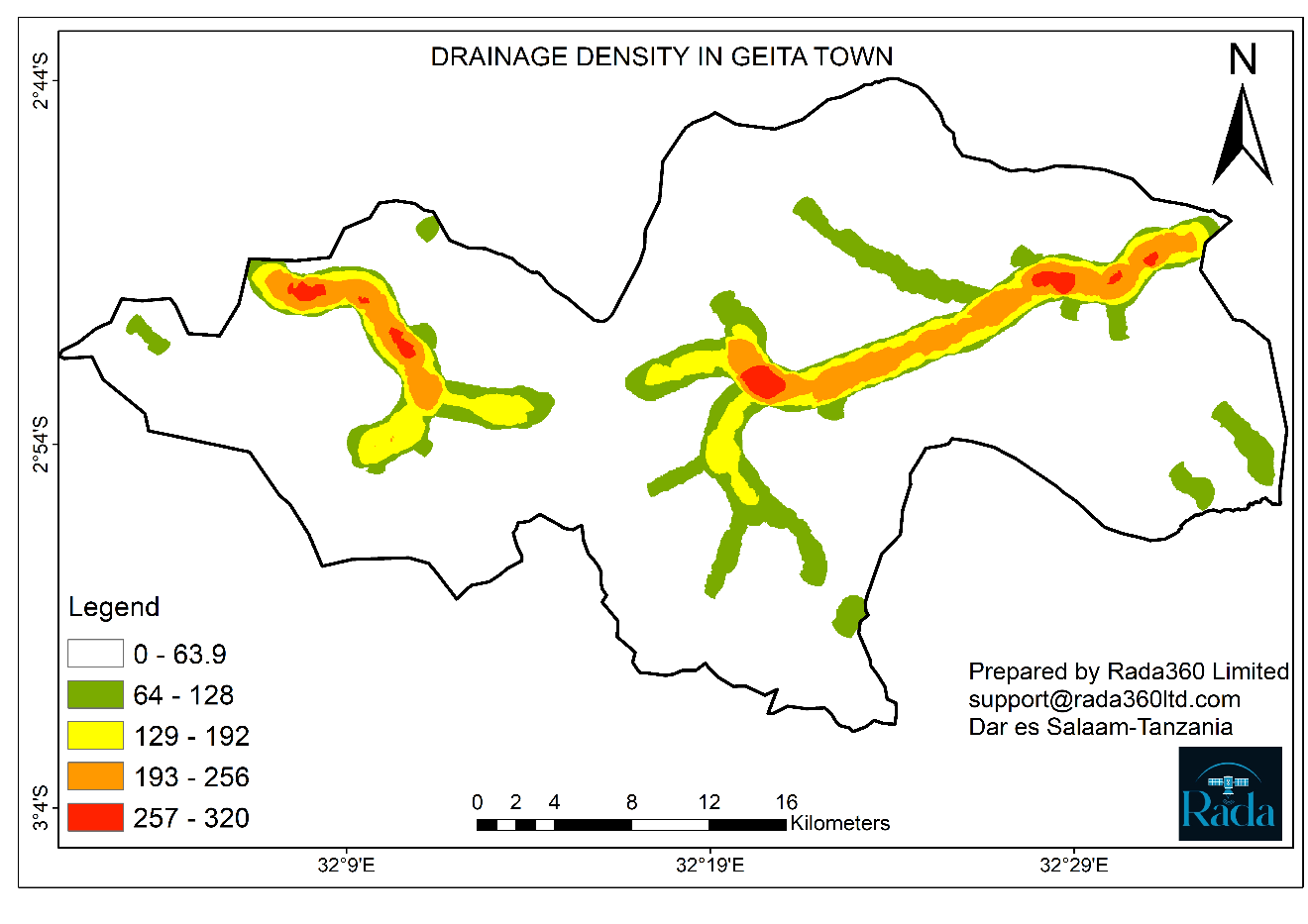
From Space to Ground: Impact Assessment
The power of satellite imagery truly shines in its ability to rapidly assess damage across vast areas. In Geita, analysts produced:
- Drainage density
- Drought Analysis: Through continuous monitoring of environmental conditions, Rada identifies and analyzes drought patterns, supporting water resource management and agricultural planning.
