Monitoring Crop Health Using Drones and IoT
Have you ever noticed that there is a portion of your farm that’s highly productive, another part of your farm is moderately productive, and other parts of your farm are poor with regard to production? Do you know why? Are you aware of the solutions to that? Great! Relax and read on!
I will try and explain it in the simplest terms possible.
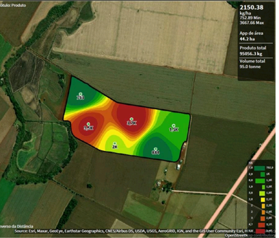
Every piece of agricultural land however small or big it may be has varying capabilities in terms of yield. This means that some parts of your land will give you a higher yield while some parts will give you a lower yield. Therefore, a particular map can be drawn on your farm with regard to how much harvest was collected from each location of your farm.

A better way of knowing how well each part of your farm is doing is by monitoring crop health. Crop health data can be achieved through the use of drones. Drones equipped with special cameras take several NDVI images all over the farm and such images upon analysis will give a clear map of the farm with regard to the distribution of its fertility.
Data from NDVI images help in developing Variable Rate Application maps that help in enabling the farmer to understand the exact requirements of each location of their farm.
Monitoring Crop Health Using Drones and IoT
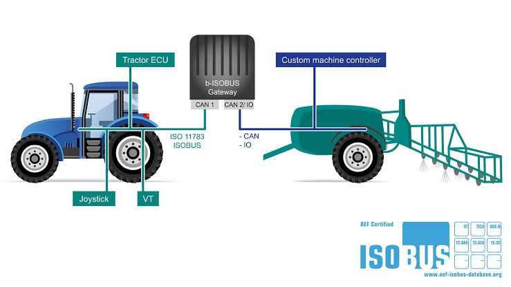
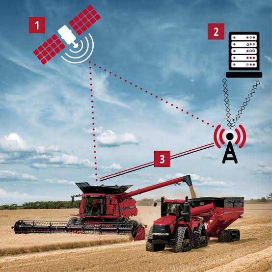
With the advancement of precision agriculture, NDVI maps from drone imagery are used in a generation of variable rate application maps (VRA maps) that are fed to precision equipment such as sprayers, spreaders, and tractors. This enables the systems onboard to determine how much farm input is suitable for a particular location of the farm (Monitoring Crop Health Using Drones and IoT)

The use of drones in the generation of NDVI MAPS is a common phenomenon that has yet to be absorbed by farmers, especially in the African region. Drones are revolutionizing agriculture; we just can’t see it yet!


